Although the cheapest toy drones can now be bought for less than PLN 100, relatively few people are aware of the full range of their capabilities and commercial applications – even in the sectors where drones have gained the most supporters, such as farmers, foresters or surveyors.
What is a UAV, or unmanned aerial vehicle, how does it relate to a UAS, and what do drones have to do with all this?
What is a UAV – what is an unmanned aerial vehicle
An unmanned aerial vehicle ( Unmanned Aerial Vehicle , or UAV for short), in its simplest definition, is a machine that does not need an on-board crew to fly, cannot carry passengers, and is either piloted remotely or flies autonomously.
In reality, the aircraft itself needs additional resources and devices to operate. These devices communicate with each other and enable the aircraft to carry out its assigned task.
UAV vs UAS – what is the difference?
UAS ( Unmanned Aerial System), i.e. an unmanned aircraft system , consists of the following components:
- the UAV – the unmanned aerial vehicle,
- a ground control station (GCS) operated by the operator,
- a communication system between the control station and the aircraft in the air,
- an interchangeable payload, used depending on the nature of the mission,
- software for processing the collected data,
- auxiliary equipment for transporting and operating the whole system.
The aircraft itself is only one part of such a system.
What do UAVs and drones have in common?
In short – they are the same thing. The word drone means the same as the technical term unmanned aerial vehicle (UAV). It is the most common, media-friendly term, used most often in journalism, the media and by hobbyists and amateurs.
It is often wrongly applied to “anything that flies and is remotely controlled”. For example, RC models are a completely separate group – their fans commonly call them racers.
The word drone itself comes from the English drone, meaning a male bee. Drones – multirotors, which have become the most popular in recent years – make a characteristic buzzing sound in flight, produced by fast-spinning propellers and similar to flying drone bees.
Types of unmanned aerial vehicles (UAV drones)
Unmanned aerial vehicles can be divided into several categories, depending on their design and propulsion.
Multirotors
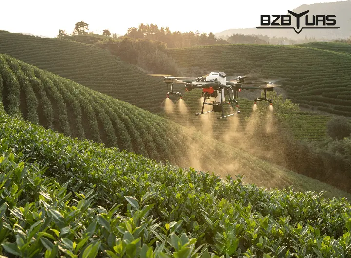
Multirotors fly thanks to the lift generated by several propellers (rotors) placed symmetrically around the drone. They are very manoeuvrable and easy to operate, and learning to fly them takes very little time.
The advantage of this design is vertical take-off and landing, which makes it possible to operate in places where other techniques are difficult or impossible to use.
The main drawback of multirotors is their relatively short flight time. For this reason, this type of drone is most often used to survey point objects or small areas (heaps, excavations, buildings).
Fixed-wing drones
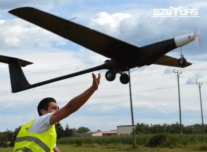
Fixed-wing drones most closely resemble classic aeroplanes. They are driven by propellers on the wings or nose and steered with flaps on the wings and tail. They are launched by hand or from a special catapult.
They have a very long flight time (even several hours) and are used to scan large areas, often linear ones (farmland, roads, gas pipelines, power lines).
Fixed-wing drones are more complicated to operate than multirotors. Most commercially available platforms only allow automatic flights – the user cannot take over control.
The critical moment is the landing approach. Setting the correct approach path requires experience, and mistakes often end with the aircraft crashing.
Helicopters
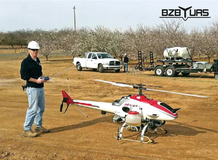
Helicopter drones resemble classic helicopters. Propulsion and control are provided by two rotors – the main rotor and the tail rotor.
Helicopters are much harder to operate than other types of drones. Servicing and preparing the drone for flight are more difficult. The main reason is the complex rotor head mechanism that controls the pitch of the main rotor blades.
However, helicopters can stay in the air longer than multirotors – up to two hours. Like multirotors, they can also take off and land vertically.
Hybrids
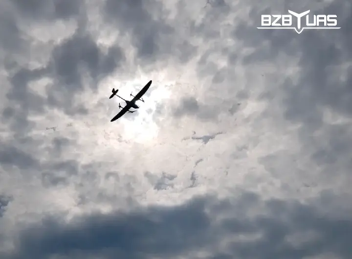
Hybrids – in this case vertical take-off fixed-wing aircraft (VTOL) – combine the features of fixed-wing drones and multirotors.
They are easy to control, can take off in difficult terrain and stay in the air for up to several hours.
UAV drone equipment
The heart of every drone is the autopilot, which controls the machine, stabilises its flight and enables autonomous flights.
The drone itself is only a tool – it still needs something that gives it practical value, such as a camera or sensor. Apart from purely recreational flights, every unmanned aerial vehicle needs a device that receives and processes the signal coming from the surveyed object. The most common types of cameras and sensors are:
LIDAR
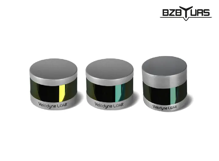
From the English Light Detection and Ranging. It works similarly to radar or sonar, but instead of microwaves or sound waves it uses reflected laser light. The laser emits short pulses of light of a specific wavelength. The reflected light is recorded, for example, by a photodiode or a CCD camera.
By analysing the intensity of the scattered light pulse, digital terrain models are created together with land cover, e.g. roads, high-voltage lines, buildings, trees, etc.
RGB camera
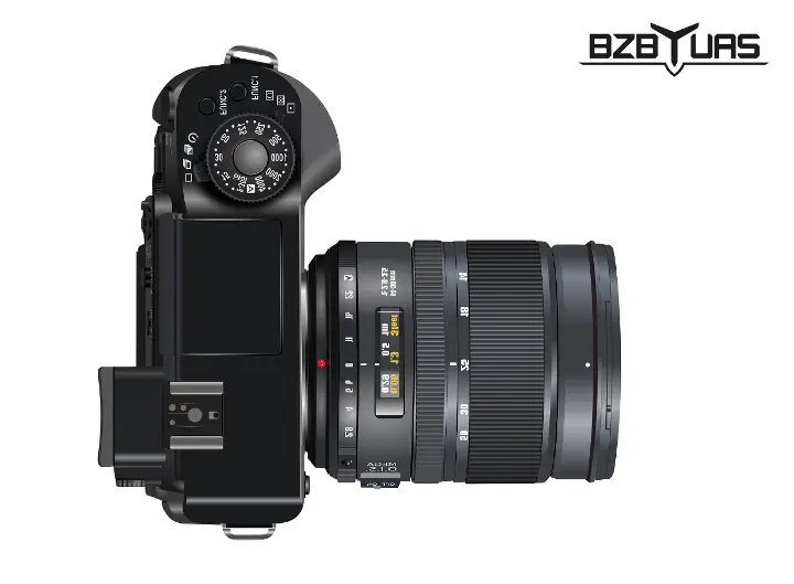
From the English Red, Green, Blue – the red, green and blue colours, the three components of the RGB colour model (hence the name). It is in fact an ordinary camera that records the visible light spectrum.
With an RGB camera you can create terrain maps with accurate colour reproduction – exactly as a person would see the area.
Multispectral and hyperspectral sensors
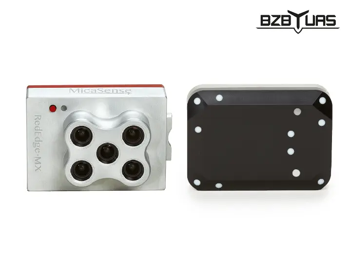
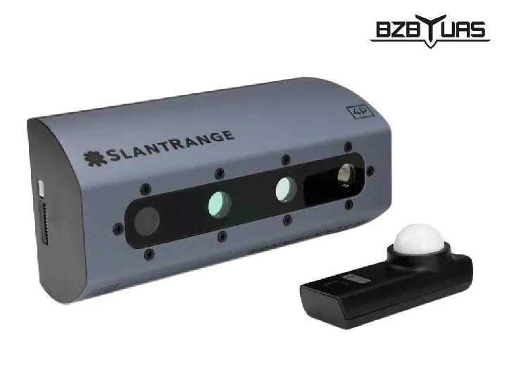
Multi-, super- and hyperspectral sensors are generalisations of the RGB camera. Beyond the visible light spectrum (RGB), they can record other spectra, such as different ranges of infrared or microwaves. Put simply, macronutrients absorb solar radiation and distort it (absorbing part of it), then emit a wave of a different length; a multi- or hyperspectral sensor precisely measures the intensity of waves at different lengths, which tells us the exact composition of macronutrients.
By analysing reflected infrared waves you can, for example, map the NDVI index used to analyse plant vegetation, determine soil moisture or trace underground pipelines.
This is not possible with an ordinary RGB camera.
Air pollution sensor
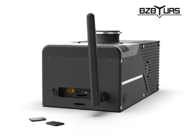
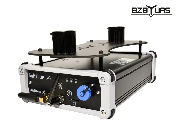
An example of a sensor that is not a camera is an air pollution sensor. Such drones are used, among others, by municipal services and fire brigades to analyse the composition of smoke from chimneys and to fight smog in many Polish cities, e.g. in Warsaw, Katowice, Bielsko-Biała.
Applications of UAVs and UAS
Very broadly speaking, unmanned aerial vehicles can be used wherever collecting data about an area from the ground is difficult, time-consuming, dangerous or impossible:
- digital orthophoto maps,
- thermal imaging measurements,
- 3D models of objects, cities and buildings,
- crop monitoring, assessment of damage caused by game animals,
- monitoring of forest areas,
- monitoring of state borders,
- support for mass events,
- rescue operations, Search and Rescue,
- surveying areas hit by natural disasters,
- military missions,
- filming and event photography.
UAVO licences
In Poland, to fly a drone for commercial purposes, three things were required:
- a qualification certificate for unmanned aerial vehicle operators – UAVO (Unmanned Aerial Vehicle Operator),
- a valid aviation medical examination,
- operator third-party liability insurance.
UAVO licences were divided into two further categories: VLOS and BVLOS.
Visual Line of Sight – within visual contact with the aircraft
A UAVO VLOS licence entitles the holder to operate the aircraft in conditions and at distances where the operator or one of the observers can maintain visual contact with it. Visual contact is maintained to control the drone's position in the airspace and to keep a safe distance from other airspace users, obstacles, people and animals.
Losing visual contact is acceptable if the operator monitors flight parameters on ground devices connected to the drone.
Beyond Visual Line of Sight – beyond visual range
BVLOS flights are mainly carried out in projects covering large areas, such as creating orthophoto maps, infrastructure inventories and monitoring of large areas.
Flying BVLOS is similar to flying a large passenger aircraft under IFR (Instrument Flight Rules), where control is based on data from on-board instruments.
With information sent over the telemetry link, the operator knows the aircraft's position, altitude, speed, flight direction and all its key parameters. At any time the operator can also change flight parameters, control the data-collection sensors (if any are on board) or trigger return-to-home and landing.
A UAVO BVLOS licence allowed long-distance flights in 4 categories:
- operational flights, for state aviation, natural disaster response or search operations,
- specialist flights, for inspection and monitoring of civil or water engineering structures, surveying and research flights,
- automatic flights, for inspection and monitoring of civil or water engineering, medical deliveries and agricultural aviation,
- training flights.
Development of the unmanned aerial vehicle market in Poland
In February 2019 at a conference at the Polish Ministry of Infrastructure the report “White Paper on the Unmanned Aerial Vehicle Market” was presented.
We encourage you to read the study on the economic, social and legislative analysis of the drone market in Poland, with forecasts up to 2026.
Unmanned aerial vehicles – FAQ
How high can a drone (UAV) fly?
During standard flights, e.g. mapping, a drone flies at an altitude of 100 to 500 metres, depending on the resolution required for the mission.
Under aviation law, above 9,500 feet above sea level (about 3,000 metres), an aircraft must have the appropriate instruments and permanent contact with air traffic control.
However, small aircraft have no need to fly that high at all. Flights at high altitudes result in lower resolution of the collected data.
Our company allows flights up to 3,000 m above sea level, e.g. for research purposes.
How fast do unmanned aerial vehicles fly?
Most aircraft reach cruising speeds of 10 to 30 metres per second. At higher speeds, data blur or sensor errors become a problem – sampling must be more frequent to achieve full coverage of the area.
Some sensors cannot sample that fast, and the camera is also limited by aperture and shutter speed – photos come out blurred or out of focus.
Our drones fly at speeds of 15–20 metres per second.
What can a UAV be used for?
A drone's specific capabilities depend on the sensors fitted. The aircraft itself is only a platform; without additional equipment it cannot perform any task (other than a recreational flight). Only the payload makes it possible to collect information and use it for imaging, mapping or specialist measurements.
How much does a UAV drone made by BZB UAS cost?
The price of a Polish-made BZB UAS UAV drone depends mainly on the equipment required. Each offer is tailored to the customer's specific situation and needs.
- For a small fixed-wing aircraft in the simplest training version, prices start at PLN 23,000 net.
- See the drones in our shop
Can UAS systems operate in rain or strong wind?
In theory drones can fly in the rain. In practice there is no need to. During rainfall, visibility and the reliability of measurements drop significantly. We do not guarantee measurements taken during rainfall.
As for strong gusts of wind, our equipment has been tested in winds gusting up to 15 metres per second (almost 7 on the Beaufort scale).
The greatest danger is not so much the wind itself as turbulence – vertical air movements or eddies near terrain obstacles. Such gusts can unbalance even the most stable aircraft.
Predicting possible turbulence requires broad knowledge and experience in planning flights in strong wind. We advise beginner operators to wait for easier weather conditions.
Source: White Paper on the Unmanned Aerial Vehicle Market