Aerial photogrammetry, laser scanning and artificial intelligence
Drones in civil engineering
Aerial photogrammetry, laser scanning and artificial intelligence
Drones in civil engineering
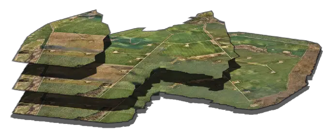
Photogrammetry, 3D modelling
Use modern technology, remote sensing and laser scanning to transfer your infrastructure to a digital model. Our orthophotomaps provide all the features of geodesic maps, while 3D models will allow you to accurately measure volumes or optimally plan the location of new buildings or video surveillance.
Photogrammetry, 3D models
Use modern technology, remote sensing and laser scanning to transfer your infrastructure to a digital model. Our maps provide all the features of surveying, while 3D models will allow you to accurately measure volumes or optimally plan the location of new buildings or monitoring.
Learn more on how are
ortophotomaps created.
Precise measurements
Carry out inventory and plan development.

Investment visualisation
Based on the map we can visualise progress and appearance of planned construction sites

Area and distance measurements
With a digital terrain model we can estimate distances
and strech of the area under examination with a high accuracy
Volume and height measurements
We measure heights, terrain slopes and land masses balance.
We calculate volumes of linear
and wide-space excavations
Geodetic maps
Ortophotomaps provide all the features of a geodetic map.
Uniform scale, a coordinate system and a map projection
Inspection of linear objects
Utilize artificial intelligence to inspect linear infrastructure, like gas&oil, powerlines, railway.
Inspection of linear objects
Utilize artificial intelligence to inspect linear infrastructure, like gas&oil, powerlines, railway.

React to interference attempts
Our original algorithms will automatically detect a potential
location where the pipeline interference may have taken place

Manage objects in the protective lane
Check where man-made objects or vegetation that threatens the infrastructure appear

We are looking for leakages
Locate leaks that are a threat to the environment.
Minimize losses
Precise network monitoring
Utilize drone imagery, remote sensing, and laser scanning to effectively monitor the condition of networks (powerlines, gas, water, oil) and detect irregularities in their operation. Terrain-following, 4G transmission and built-in safety systems ensure stable real-time monitoring, precise data collection, support for hazard detection and maintenance planning.
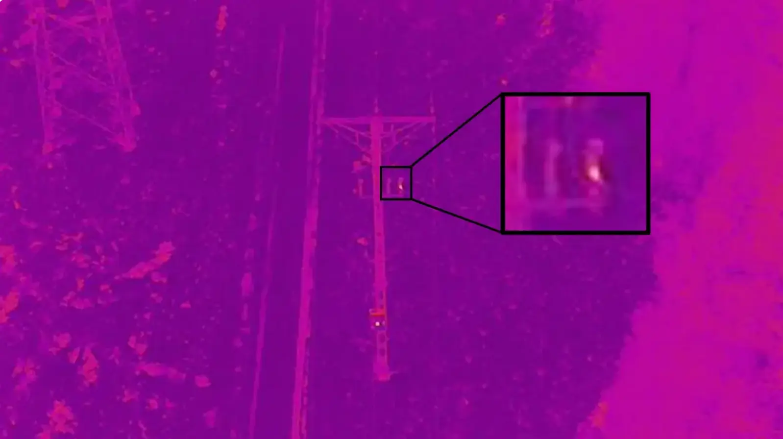
Thermal Inspections
Thermal images enable the detection of overheating components, leaks, overloads and other temperature anomalies, providing precise localization of potential failures and effective assessment of the technical condition of infrastructure.
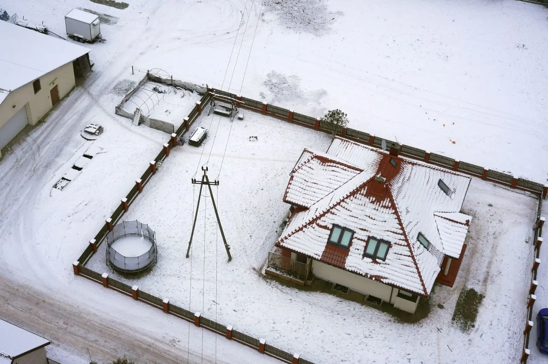
RGB Inspections
High-resolution images in natural colors (RGB) allow for quick identification of mechanical damage, corrosion, structural tilts and other visible signs of wear, ensuring efficient location and documentation of defects.
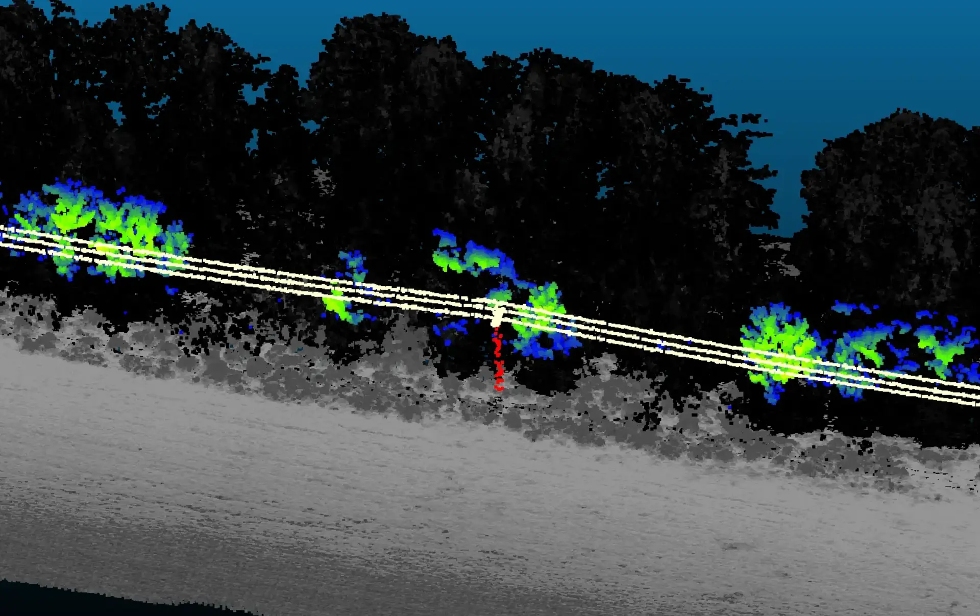
LiDAR Inspections
LiDAR scanning enables precise measurement of the geometry of infrastructure and its surroundings, allowing for the detection of hazardous proximity of vegetation to infrastructure, structural deviations or changes in terrain shape, providing accurate spatial analysis and support in planning maintenance activities.
Precise network monitoring
Utilize drone imagery, remote sensing, and laser scanning to effectively monitor the condition of networks (powerlines, gas, water, oil) and detect irregularities in their operation. Terrain-following, 4G transmission and built-in safety systems ensure stable real-time monitoring, precise data collection, support for hazard detection and maintenance planning.
Thermal Inspections
Thermal images enable the detection of overheating components, leaks, overloads and other temperature anomalies, providing precise localization of potential failures and effective assessment of the technical condition of infrastructure.
RGB Inspections
High-resolution images in natural colors (RGB) allow for quick identification of mechanical damage, corrosion, structural tilts and other visible signs of wear, ensuring efficient location and documentation of defects.
LiDAR Inspections
LiDAR scanning enables precise measurement of the geometry of infrastructure and its surroundings, allowing for the detection of hazardous proximity of vegetation to infrastructure, structural deviations or changes in terrain shape, providing accurate spatial analysis and support in planning maintenance activities.
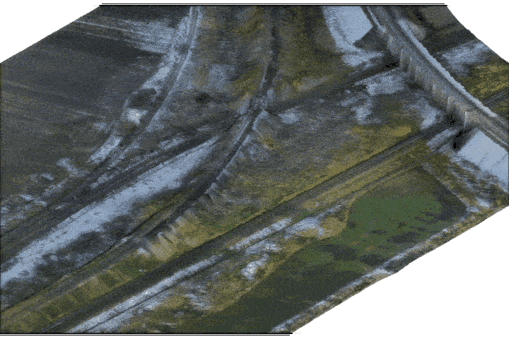
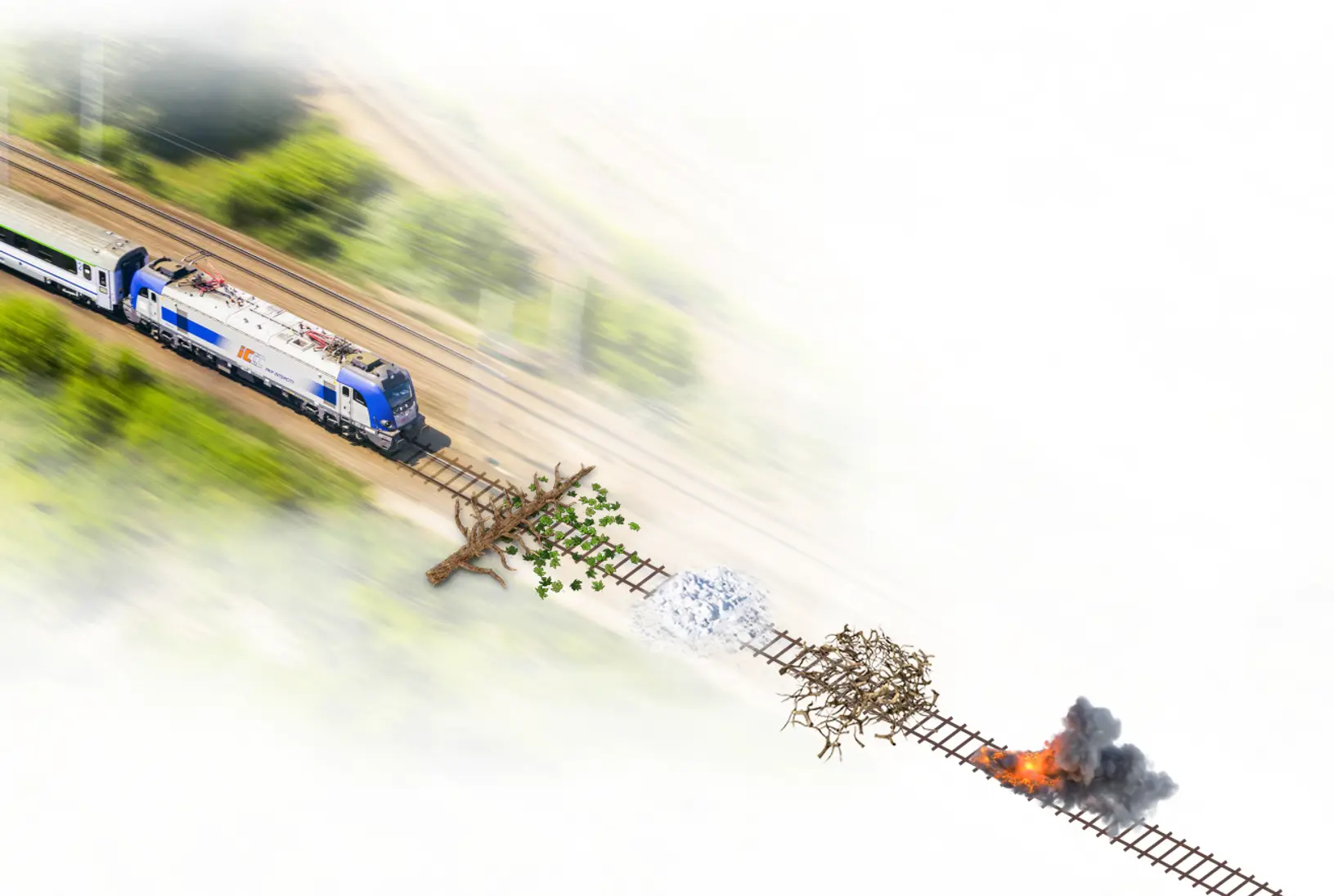
Railway inventory in detail
We provide high-precision aerial surveys for railway infrastructure, combining orthophotomaps wth advanced spatial analysis.
Our solutions enable automated detection of track interferences including vegetation, fallen branches, debris, snowdrifts and other obstructions that may impact rail operations.
We calculate distances between track components and surrounding objects, as well as deviations from nominal design parameters.
Get accurate insight that supports maintenance planning, safety compliance and proper railway performance!
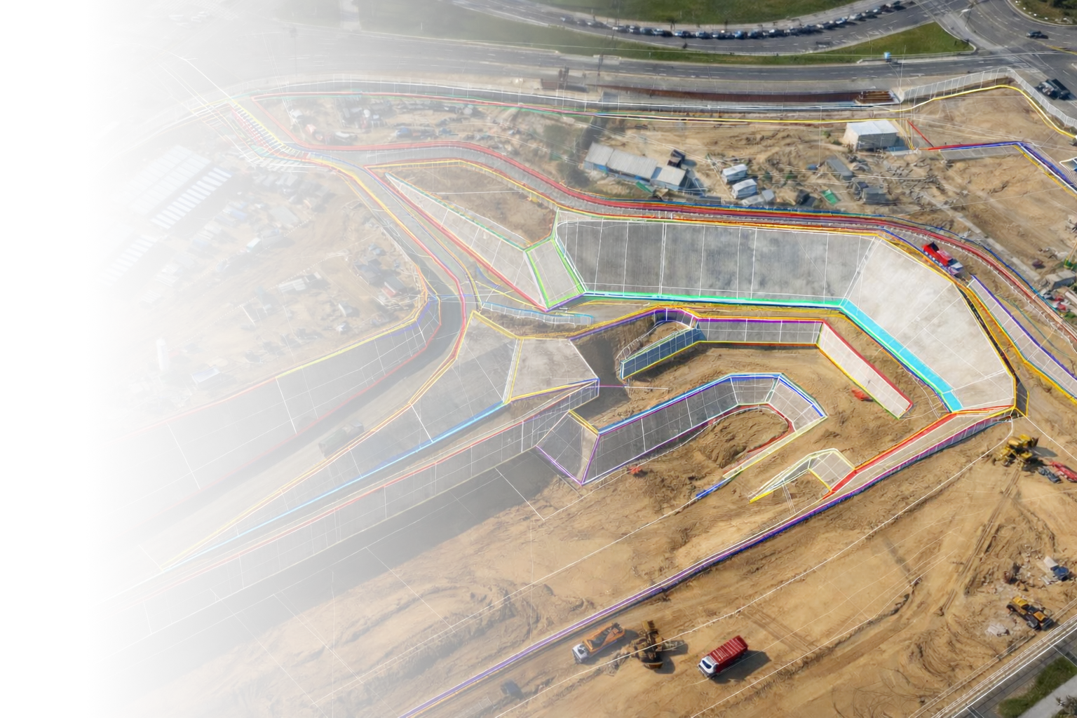
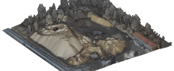
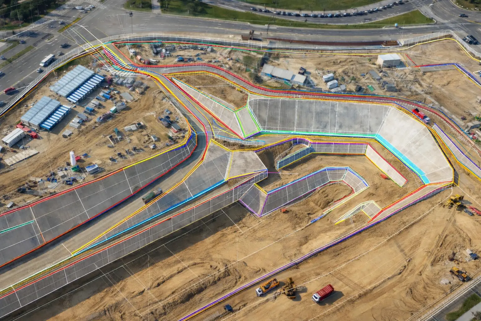
Construction site visualisation and progress tracking
Conduct inspections during construction period:
- Track progress in real time with high-resolution aerial imagery.
- Compare as-built structures with design models for early detection of deviations.
- Monitor safety and compliance on site efficiently.
- Support decision-making with precise measurements of areas, volumes and elevations.
- Integrate data with BIM for optimized project management and resource planning.
Wirtual walk
Railway inventory in detail
We provide high-precision aerial surveys for railway infrastructure, combining orthophotomaps wth advanced spatial analysis.
Our solutions enable automated detection of track interferences including vegetation, fallen branches, debris, snowdrifts and other obstructions that may impact rail operations.
We calculate distances between track components and surrounding objects, as well as deviations from nominal design parameters.
Get accurate insight that supports maintenance planning, safety compliance and proper railway performance!
Wirtual walk
Construction site visualisation and progress tracking
Conduct inspections during construction period:
- Track progress in real time with high-resolution aerial imagery.
- Compare as-built structures with design models for early detection of deviations.
- Monitor safety and compliance on site efficiently.
- Support decision-making with precise measurements of areas, volumes and elevations.
- Integrate data with BIM for optimized project management and resource planning.


