Spatial analysis, AI-powered models and more
Control your terrain. Predict risks. Act faster.
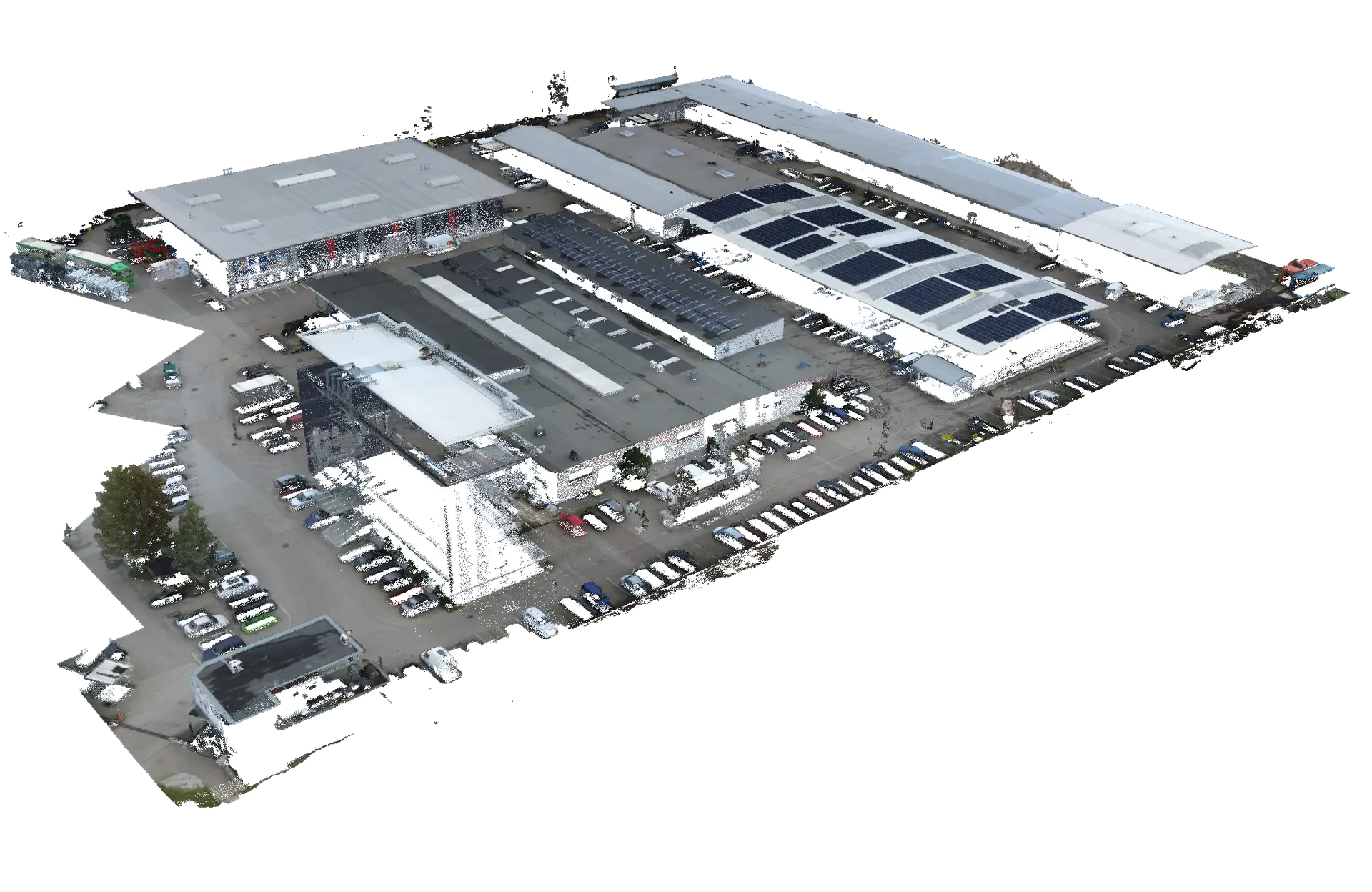
Aerial data for advanced spatial analysis.
Advanced geospatial intelligence
Improve safety and efficiency in infrastructure management. Identify obstacles that may affect the proper operation of technical assets. Monitor land-cover changes and provide reliable data for planning and preventive actions.
We deliver high-resolution aerial data and advanced spatial analytics tailored to specific operational challenges. While forestry and civil engineering represent key application areas, our capabilities extend far beyond predefined sectors — supporting cities, infrastructure operators, agriculture, and environmental monitoring.
We design the methodology around your objective
Discover our capabilities
Land Cover Classification
Classify land cover using high-resolution aerial imagery and AI models.
Boundary Monitoring
Detect changes along property boundaries, transport corridors and other areas.
Change Detection Analysis
Compare multi-temporal aerial datasets to identify spatial changes over time.
Surface Damage Detection
Identify surface degradation such as cracks, bituminous damage or erosion.
Flood and Water Accumulation Mapping
Monitor and map flood events and water accumulation.
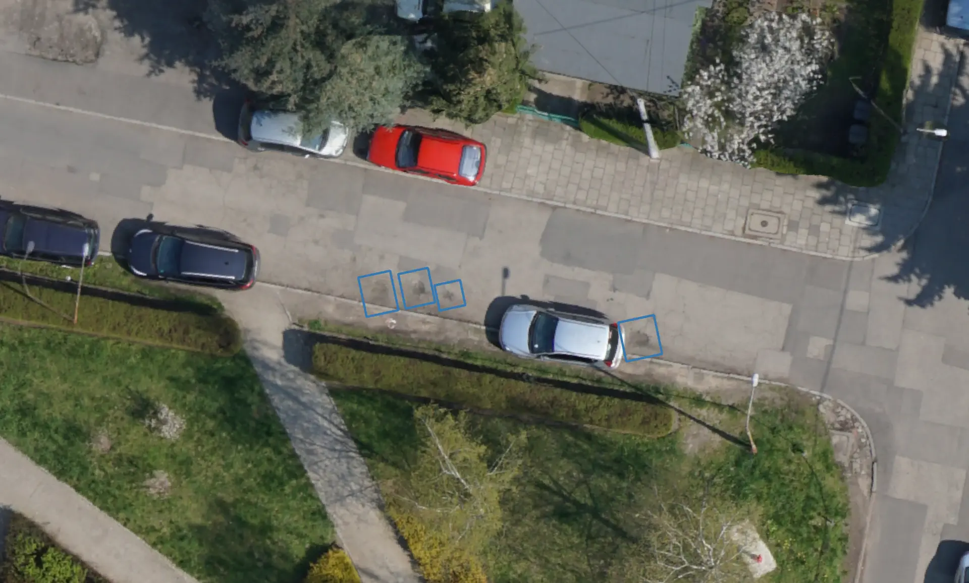
Wildlife Damage Detection
Identify crop stress patterns and field damage caused by wildlife activity.
Vegetation Interference Detection
Detect vegetation that may interfere with operational zones such as airports.
Tree Detection and Inventory
Automatically detect and count trees across large areas.
Discover our capabilities
Land Cover Classification
Classify land cover using high-resolution aerial imagery and AI models.
Boundary Monitoring
Detect changes along property boundaries, transport corridors and other areas.
Flood and Water Accumulation Mapping
Monitor and map flood events and water accumulation
Vegetation Interference Detection
Detect vegetation that may interfere with operational zones such as airports.
Change Detection Analysis
Detect vegetation that may interfere with operational zones such as airports.
Wildlife Damage Detection
Identify crop stress patterns and field damage caused by wildlife activity.
Surface Damage Detection
Identify surface degradation such as cracks, bituminous damage or erosion.
Tree Detection and Inventory
Automatically detect and count trees across large areas.
Explore our dedicated solutions for key industries
Civil Engineering
From volumetric analysis to linear asset inspection. Measurement data, orthomosaics, 3D models enable accurate, efficient and data-driven engineering workflows.
Forestry
Orthomosaics and spatial models enable automated detection of bark beetle outbreaks, mistletoe infestations and declining trees across extensive forest areas.
Example Applications of Spatial Analysis
Below are selected examples of how advanced spatial analytics can be applied beyond sector-specific workflows.
Aerial insight for modern cities
Precise geospatial data and automated analysis tailored to the operational needs of the city.
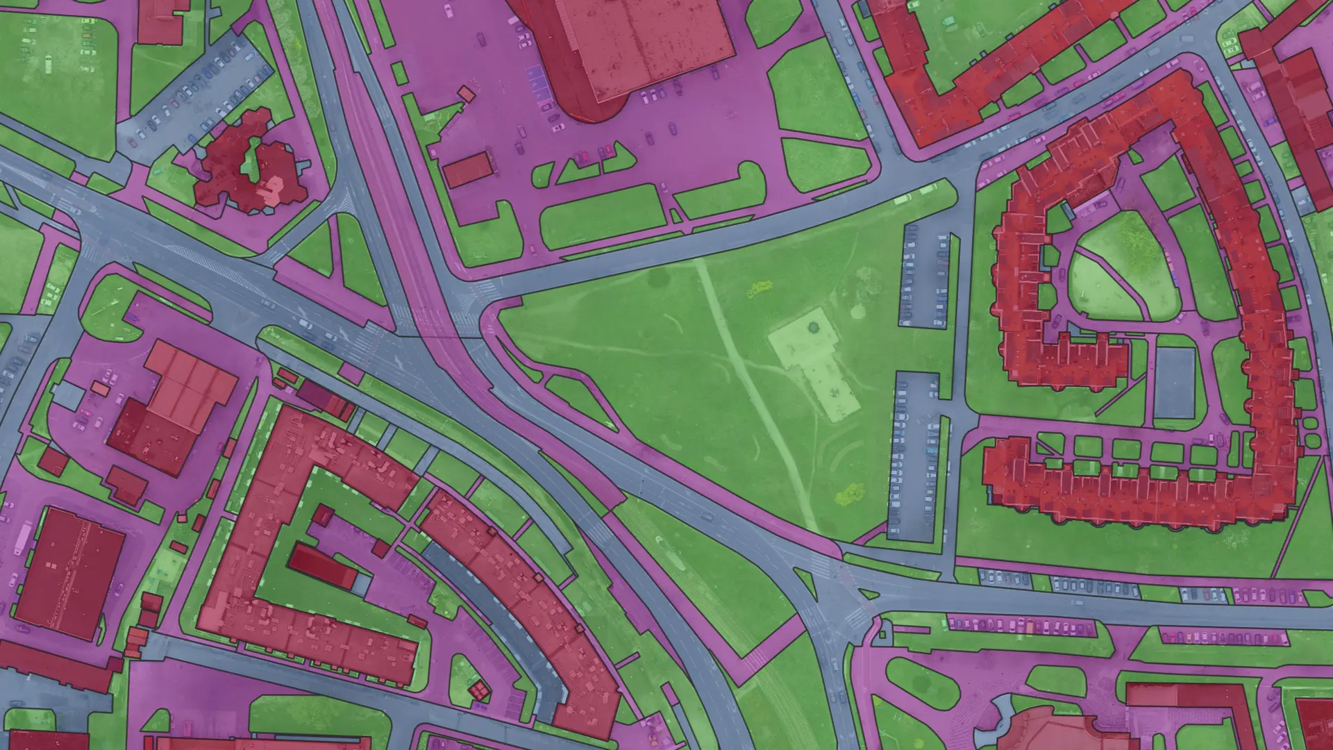
Land cover classification
We use AI-based models to identify built-up areas, green spaces, roads and other surfaces. This supports urban planning, environmental monitoring, and spatial policy decisions.
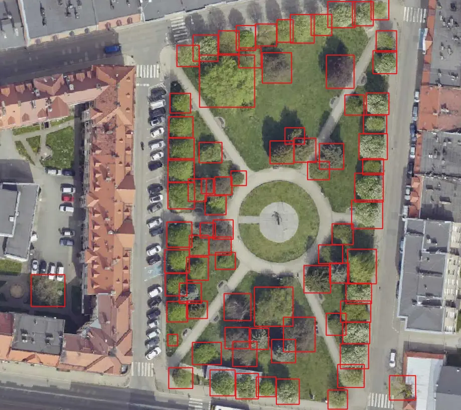
Automated tree detection and inventory
Our algorithms automatically detect and count trees across large urban areas. Regular updates enable monitoring of canopy changes and support urban forestry planning.
Bituminous surface damage detection
We detect damages to bituminous surfaces, including cracks and surface degradation. Automated detection reduces the need for time-consuming manual inspections.
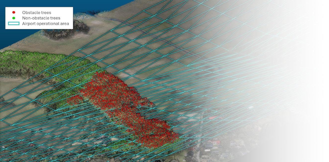
Airport operational area analysis
Ensure compliance with aviation safety requirements.
We perform detailed analyses of natural obstacles within airport operational areas and identify locations where vegetation may exceed permitted height limits. Early detection of potential conflicts with operational zones enables effective preventive planning and helps maintain required aviation safety standards.
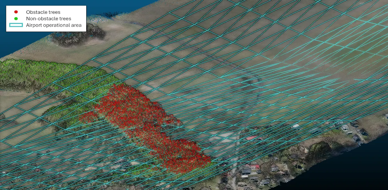
Your Goal. Our Strategy.
Every project begins with a clearly defined operational goal. We design the best data acquisition strategy, processing workflow and analytical model around your specific challenge.


