What is an orthophoto map – definition and features
By definition, an orthophoto map is “a photographic map created by differential rectification of an aerial photograph”. That definition can be hard to digest, so let's take a closer look.
How does an orthophoto map differ from an aerial photo?
Orthophoto maps are most often made by processing satellite images, aerial photos or drone images. The main difference is the change of projection (perspective) from a central projection to an orthogonal projection – one that is perpendicular to the photographed plane.
Hence the name: “ortho” – from orthogonal projection, “photo” – from photography, and “map” – because the final product can be used for the same purposes as a map and has some of its features: a scale, a coordinate system and preserved proportions, and it can be used for measurements.
Central projection (where the “centre” is a single point – the camera sensor) causes apparent distortion of space and an uneven scale. The larger the photographed area, the greater the terrain differences and the shorter the focal length (the wider the lens angle), the greater the distortion.
An extreme case can be seen with a fisheye lens, where distortion is deliberately not corrected.
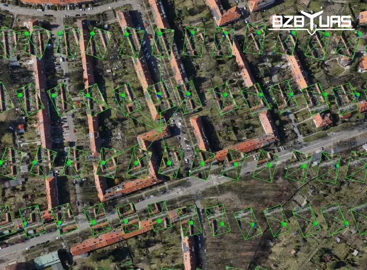
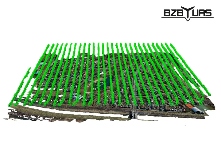
In orthogonal projection, every point of the surveyed plane is photographed perpendicularly, straight from above. To achieve this, orthophoto maps are created by taking hundreds of photos of the area and then combining them through orthorectification and mosaicking.
True orthophoto
Objects protruding above or below the surface of an orthophoto map may be distorted or slightly shifted – their scale is not preserved. They can also hide other objects behind them.
Using drones and collecting photos with high overlap makes it possible to combine the images so that the outlines of buildings (or other tall elements) are projected exactly onto their bases. In that case we speak of a “true orthophoto”.
Orthophoto map accuracy – GSD
The accuracy and level of detail of an orthophoto map depend mainly on its resolution – the ground size of a pixel, known as Ground Sampling Distance (GSD).
- A GSD of around 30 cm/px allows features such as buildings and roads to be identified.
- A GSD of around 10 cm/px allows more detailed inspection of urban areas – distinguishing traffic lanes, paving slabs, ground installations, building and plot boundaries,
- A GSD of around 5 cm/px is already very detailed and allows inspections of roofs, gutters and tiles, distance and volume measurements, identifying individual people, etc.
- A GSD of around 1 cm/px characterises the most accurate orthophoto maps, which can be used as the basis for work submitted to the district surveying records office (ODGiK) in Poland.
These resolutions are much more accurate than those found in traditional photogrammetry. The information and measurements obtained this way make it possible to partly or fully dispense with further land surveying.
Orthophoto maps – applications
Orthophoto maps are used wherever a precise and accurate representation of the terrain is needed (for measurements or visualisation). Although the range of applications is wide, two main areas seem to dominate – maps for civil engineering and maps used in environmental analysis.
Investment projects and promotion
Digital maps can help at every stage of a construction or infrastructure project – from presenting the site and visualising development plans to investors, through inventory of divided plots and land sales, to promoting the finished investment.
As part of such promotion, you can run marketing campaigns presenting a place or building, or create a visualisation of an area, e.g. at tourist or ski resorts, showing available runs, trails and viewpoints.
Civil engineering – planning construction work
Drone orthophoto maps are used in designing and carrying out construction work. Ongoing work is monitored without having to stop it. Successive construction stages are assessed regularly. After completion, an as-built inventory is made, e.g. by comparing the work done with the plans and the order.
Terrain maps are also used in planning, building and inventorying infrastructure such as roads, railways, industrial lines, power lines and gas pipelines.
Inventory of excavations and stockpiles
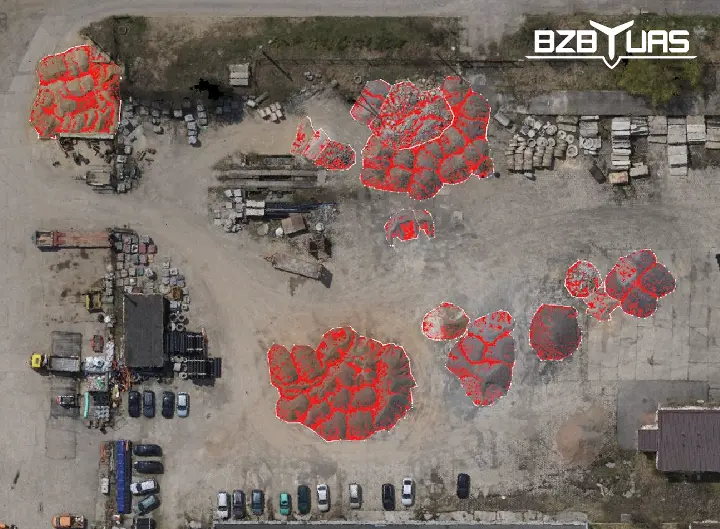
For sites such as excavations, stockpiles, warehouses and open-pit mines, 3D models of these industrial areas are created. They are used for measurement, planning and monitoring. The volume of extracted material, stored materials such as aggregates and stock levels are measured. The volume of delivered bulk materials is compared and deliveries are checked against orders. The volume of earth masses is measured and the cost and time of removal, e.g. from a construction site, is estimated.
This is also how the growth rate of landfills, scrapyards, etc. is monitored.
Land and building records
For land and building records, digital orthophoto maps are used to determine plot boundaries and to measure their area and distances in space.
Reference to other maps
This is also how older existing maps are updated or different types of maps are compared (which can reveal unauthorised construction or illegal waste dumps).
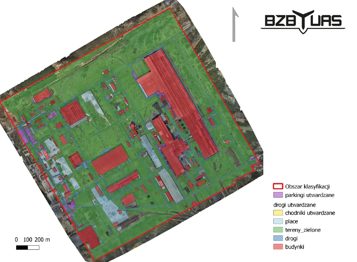
A vector map, e.g. of roads, buildings or power lines, can be overlaid on a raster map (photo map).
You can also create a CIR (Color-InfraRed) map, made from infrared images. Such maps are used, for example, to assess the condition of crops and tree stands, soil moisture, or to detect underground pipelines.
Monitoring terrain changes
Maps of an area created at regular intervals make it possible to monitor and detect changes in the natural environment. Parameters such as landslides, surface water levels or the type and density of vegetation can be monitored.
Combined with changes in the natural environment, plans for the development of settlements (urbanisation) can be presented.
Environmental analysis
In environmental analysis, digital orthophoto maps make it possible to monitor the condition of fields, forests, rivers, lakes, land, etc. In forests they are used to assess the condition of tree stands, detect damage (broken and uprooted trees, fires), pest outbreaks and to monitor biodiversity.
Documenting natural disasters
In the event of natural disasters such as fires, floods, flash flooding or droughts, it is possible to track their progress and document the extent and type of damage.
Precision agriculture
Drones with multispectral cameras are also used in agriculture. An orthophoto map of crops makes it possible to optimise fertilisation, check crop growth, record damage or assess soil drainage.
Archaeological prospecting
Digital terrain maps are sometimes used for such unusual purposes as archaeological prospecting, which would be difficult to do from the ground.
Digital orthophoto maps from drones – planning a photogrammetric flight
Put simply, a drone with a camera takes hundreds of photos of the mapped area, which are then processed and combined into a single map.
Flight planning
The first step is to plan the flight and choose the right parameters. Depending on the purpose of the mapping, you decide on:
- the type of drone – fixed-wing for linear objects (e.g. a road, a river) and large areas, or a multirotor for small local areas, such as measurements on a construction site,
- the camera and sensor resolution, depending on the required pixel size – GSD,
- forward and side overlap – up to 80% for precise terrain models and true orthophotos.
Ground control points
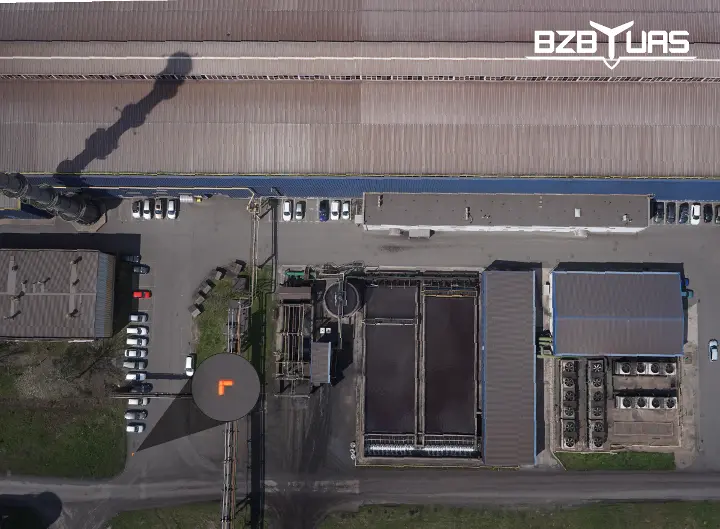
Next, the photogrammetric control is chosen. This is a set of ground control points – points that can be clearly identified (together with their coordinates) both in the photos and on the ground. They can be special markers painted on the ground or naturally occurring points such as manholes or the centre of a roundabout.
Carrying out the flight
The flight is planned in dedicated software that controls the aircraft's parameters and steers it during the flight. At this stage, hundreds of photos are captured together with geoposition (GPS) data and the camera's orientation in space – the exterior orientation parameters (IMU – inertial measurement unit).
Point cloud
In the next step, a computer algorithm performs a process called matching, based on GPS data and the exterior and interior orientation parameters (lens focal length, sensor resolution, lens distortion). It finds common points, so-called tie points, and connects them between photos.
Aerotriangulation
Then another iterative aerotriangulation algorithm combines the set of photos into a geometric network. It uses the connected photos, camera self-calibration data and ground control points to orient the whole in a known coordinate system using GPS data.
On this basis, a DSM – digital surface model – is created.
Orthorectification
A digital terrain model (DTM, or DSM for photos with infrastructure and vegetation) is not yet an orthophoto map. The final stage is to project the photos onto the previously obtained digital terrain model (i.e. changing the central projection to an orthogonal, perpendicular one) and mosaicking (joining many map fragments into a whole).
Advantages of orthophoto maps made with unmanned aircraft (UAS/UAV)
True orthophoto
One of the parameters of a photogrammetric drone flight is the overlap (forward and side). In practice, this means how much of two consecutive photos is shared. The greater the overlap, the more densely the photos are taken.
With an overlap of around 80%, you can obtain a true orthophoto, with no perspective distortion of tall objects and no hidden parts of the terrain. Objects are projected perpendicularly onto their bases.
Better than satellite images
Drones take photos from an altitude of around 50–500 metres above ground. In addition, flights are planned according to the weather forecast. This avoids clouds and fog in the photos, and high air humidity over such a short distance does not distort the colours. Drone photos have vivid, well-reproduced colours.
The cost of making such a map is also relatively low, and results can be delivered within 24 hours.
Mobility
The high mobility of drones means flights can be carried out almost anywhere and at any time. The main limitations are the weather (wind speed, precipitation), possible take-off and landing sites, and no-fly zones.
Working in difficult conditions
Drones can also work in terrain that is difficult or inaccessible for a surveyor – for example over open-pit mines, construction sites, rocky or marshy ground. When flying over and mapping construction sites, there is no need to stop work.
Need a digital orthophoto map?
Take measurements and plan the use of your land. Order an orthophoto map from BZB UAS