Farmers are experienced and educated people who like what is proven. They are often wary of change. At the same time, they know that technology keeps developing, so they are curious about solutions that will help them improve production efficiency and modernise their business. This is where drones and precision agriculture come in.
What problems do farmers face?
The biggest limitation farmers face is a lack of sufficient knowledge about what is happening to the plants while they grow. On large areas there is no time or resources to examine plant health precisely. This leads to actions based only on assumptions and guesswork. An important part of growing crops correctly is giving them the right amount of fertiliser, which stimulates growth and protects against pests. Both too littleand too much fertiliser will reduce yields, and with them income. A common problem is losses caused by wild game. Farmers can of course claim compensation from hunting associations, but this involves several difficulties. Firstly, the damage measurements carried out by hunting associations are imprecise and can lead to undervalued compensation. Secondly, not all damage can be noticed straight away.
How can drones support agriculture?
While farming practices have remained unchanged for many years, new technologies keep appearing that aim to raise the quality of farmers' work and, above all, speed up decision-making and increase precision.
An orthophoto map is an ideal tool for optimising fertilisation, checking crop growth, recording damage and examining field drainage.
Find out more about orthophoto maps in the video on our YouTube channel!
Remote sensing uses the ability of plants to reflect, absorb and transmit electromagnetic waves emitted by the Sun. We use these reflections to assess plant health and plan fertilisation, because they allow us to identify areas that, for example, may not be sufficiently fertilised.
A prescription map is used for variable-rate fertiliser application. It provides the information on plant condition needed to give plants the optimal amount of fertiliser for even nutrition across the whole field. All the methods we provide make it possible to introduce so-called precision agriculture on the farm, which reduces spending on fertiliser and fuel and helps choose the best harvest date.
The Koliber unmanned aircraft is professional equipment that offers safety and comfortable operation. It can deliver the right data from large areas within a radius of up to 20 km, and a single flight lasts 150 minutes. All these features put it among the leading unmanned systems. A survey and collection of the necessary data from large areas can be done in one go.
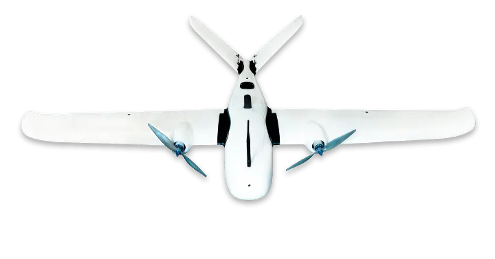
EkoSKY is a project for an unmanned aircraft made of composite parts and powered only by electric motors, which can stay in the air for up to 240 minutes. Its Plug&Play system makes flight preparation and operation surprisingly simple and convenient.
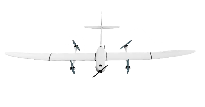
It is the Koliber and ekoSKY unmanned aircraft that allow us to introduce optimal solutions and advanced technologies, which can then be used for agriculture.
The NDVI index – multispectral cameras
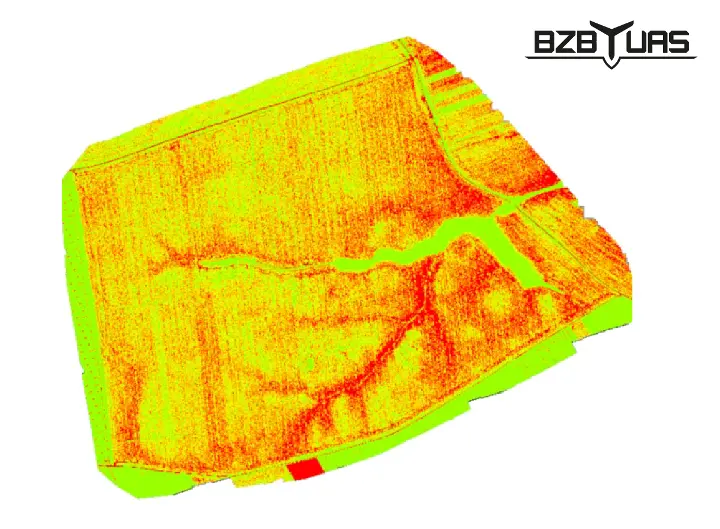
One of the indices that drone technology provides to farmers is NDVI (Normalized Difference Vegetation Index – the normalised difference vegetation index), i.e. a plant vegetation index. A multispectral camera measures the intensity of light reflected and absorbed in the infrared and red bands.
Based on it, you can detect living, green parts of plants as well as plants that for some reason are not developing properly.
This data is used to find the cause of abnormal growth, apply the right dose of the right fertiliser or spray, plan crops for the following years or detect problems with field drainage. All these actions lead to savings and maximise profits from the harvest.
Artificial intelligence in agriculture
Drones in agriculture are not only modern sensors and maps with indices. They also mean highly specialised artificial intelligence (AI) algorithms that support or replace human work.
Growing access to ever larger amounts of high-quality data means that machine learning and artificial intelligence algorithms are rapidly entering agriculture. This brings, for example, the potential to automate time-consuming and repetitive tasks done by the farmer, or to learn relationships and processes in plant development that go beyond the best experience of farmers.
In the future such a digitised farm may require only minimal intervention from the farmer. Drones will automatically fly over and scan the land and crops, decide when to sow, spray or harvest, and then coordinate the work of the rest of the automated farm equipment. All to maximise the farmer's profits and savings and make the work more convenient.
Benefits of using drones in agriculture
Multiple cameras and advanced IT technology provide information such as: soil moisture, concentrations of fertilisers and essential micronutrients, plant development stage, presence of pests and crop ripeness.
Because plant condition can be examined, the farmer can estimate how much fertiliser to give the crops. This improves harvest efficiency, maximises yields and saves money. The precision and accuracy of our methods make it possible to inspect even individual plants. A perfect example is a vineyard, where a drone with a camera scans the whole plantation. Based on the generated report, bushes with ripe fruit can be identified. Drones are also very good at analysing large areas such as forests and orchards, which may contain tens of thousands of trees. A drone can calculate the exact number of trees and determine their species, age and size. An orthophoto map made with a drone allows you to estimate game damage and losses caused by pests or natural forces. The data collected helps determine the exact extent, severity and location of the damage. This makes it possible to take the right corrective action and protect crops in the coming years. Maps prepared in this way can be attached to the documentation as evidence to obtain fair compensation from a hunting association or insurer.
The undeniable advantages of using drones in agriculture are: speed of action and the ability to collect large amounts of data in a single flight. Unmanned aircraft can take off and land in hard-to-reach places, and the advanced technology that comes with them makes it possible to automate tasks related to crop growing.
BZB UAS and SOLARIS Zenon Masiarz
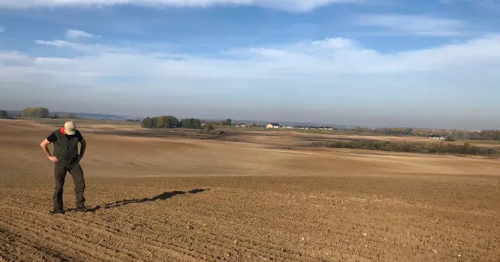
A regular customer who uses our drone services for agriculture is Mr Zenon Masiarz, owner of Solaris, a company that is also active in agritourism and forest monitoring. We have had the pleasure of working with Mr Masiarz since 2019. In 2020 alone we carried out jobs for his company covering a total of 542 hectares, and advanced technology has become a permanent part of his business. It is a perfect example of how drones help farms develop and put into practice the principles of precision agriculture, which is based on speed of action, efficiency, precision, mobility and automation.